 It may surprise those who have never been to the Willard Munger State Trail, but there are many things for you to see along the way. It is a span of 63 miles if you travel between Hinckley and Duluth via one segment, but it is a place where you see virtually anything imaginable. There are paved roads, abandoned railways, and more. Other trails include 80 miles of natural trail on the Boundary Segment and of course the original Willard Munger State Trail where you can walk or ride your bike along the railroad that saved a lot of people from the fire. With all of the things to see along the trail, nature is only a piece of the big picture.
The Hinckley Fire Museum
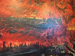 This museum is located near the southern trailhead. It tells the story of that tragic forest fire that burned the town Hinckley, as well as others, and killed many people. From there, if you tour the entire trail, you will pass through beautiful fields, woods, and have the ability to go through several small towns.
Skunk Lake Historical Site
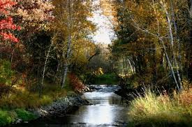 Skunk lake was a part of the evacuation route back in 1894 when the fire broke out. Now, it is little more than swamp lands, but there are numerous markers for you to explore that depict the story of how some people fled the train and survived in that swamp.
River Crossings Area
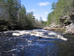 This area offers views of the water that makes Kettle River, which eventually flows into Banning State Park. It is the part of the trails that offer outstanding water views and you will be surrounded by the sound of running water.
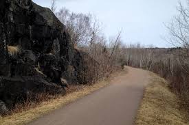
Willard Munger Trail North End
The northern end of the trail takes a 15 mile decent from Carlton. Along this stretch, you will have the opportunity to view trees and rock walls, as well as many other scenic areas. There is even a place for you to step off your bike and relax on the hillside overlooking Duluth and water all around.